Akas
Live air quality and heat for every province of Cambodia on one map, Khmer first
2026Product, design and engineering
01 / Overview
Overview
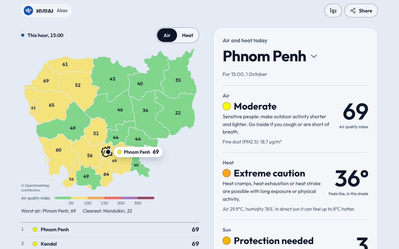
In the burning season the air in parts of Cambodia is unhealthy for weeks, and most provinces have no public sensor, so Akas shows the whole country at once: a map of all 25 provinces coloured by this hour's air or heat, every province ranked, and one province in full for the next 24 hours and three days. The index is the US EPA's, worked out from a Copernicus model through Open-Meteo, and the page says plainly that it is a model's estimate. It refreshes itself every half hour, and every province has its own page in Khmer and English.
02 / Stack
Stack
 TypeScript
 Vue
 Vite
 SVG
- Open-Meteo
 Playwright
03 / Where it stands
Where it stands
Live at akas-kh.vercel.app since 1 October 2026 as a static site: no account, no advertising and no server of its own. The air reading is a model's estimate in squares about 45 km wide, not a street sensor and not medical advice, and the free data service it reads allows non-commercial use only. It launched this month, so no usage is claimed.
Working on something similar?
Tell me what you're building.